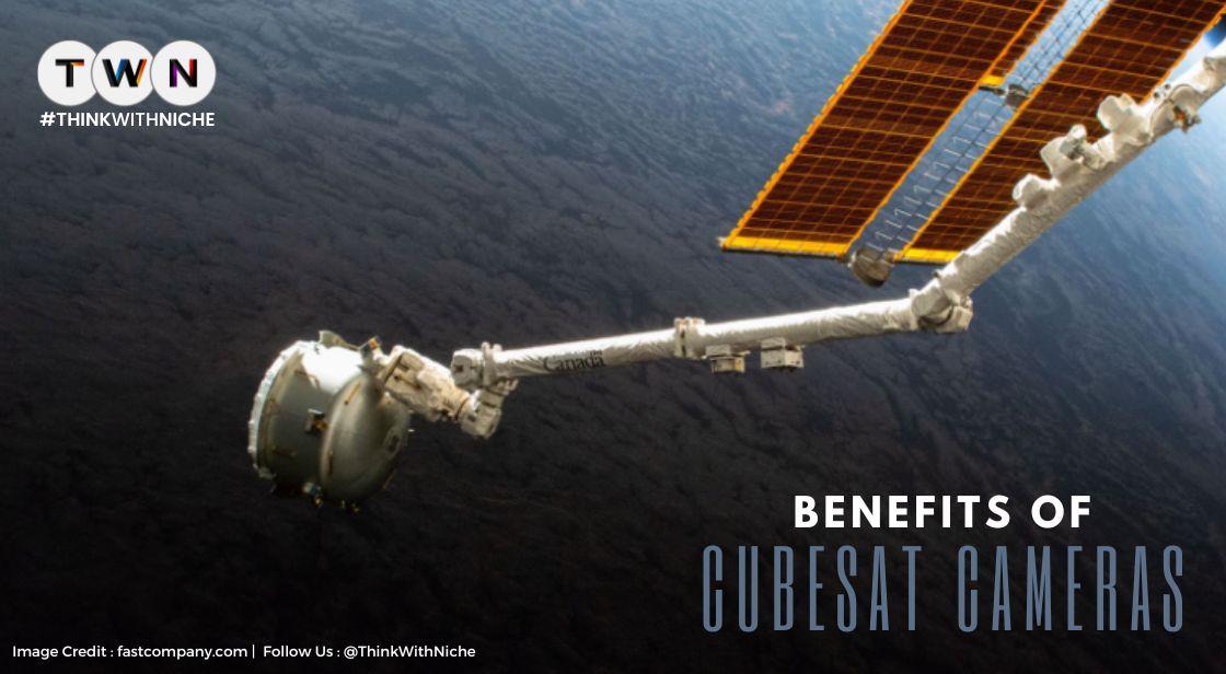
CubeSat Cameras For High-Resolution Image And Video In A Low-Cost Satellite Platform
Blog Post
A CubeSat optical camera was initially only accessible to companies with the resources (both financial and human) to enter orbit. This hasn't changed, though. They were utilized more often than ever once CubeSat was introduced. All of the space restrictions were erased by small satellites for businesses of all sizes. The lowering of prices was made possible by technological advancements. This eventually results in shorter wait times for the execution of future space projects.
CubeSat cameras are used on low-cost satellite platforms to capture sharp photos and videos. These imagers are perfect for analyzing business intelligence data and tracking changes to the planet. These are compact and reasonably priced, and they capture excellent images.
CubeSat cameras are optical imagers that work just like other space optical systems. CubeSat cameras capture the signal reflected by an object and store a hyper-, multispectral, or panchromatic image. CubeSat images can present visible or infrared electromagnetic radiation. Because they are small and don’t cost that much (compared to other spacecraft), swarms of them can orbit the planet to monitor the atmosphere, clouds, ionosphere, and Earth’s surface. However, since they have a very small volume, there are some miniaturization constraints in place. These constraints relate to energy consumption, weight, and payload dimensions. Conventional remote sensing refracting lenses are big and have a large mass, so adding optics that are long in focal length to a CubeSat camera is challenging. There are linear dimension limitations in place.
CubeSat Cameras For High-Resolution Image And Video In A Low-Cost Satellite Platform
What kinds of cameras are CubeSats equipped with?
CubeSats are usually equipped with cameras that index each of our planet’s corners in real-time. Even if they impose some limits when it comes to power and payload, they remain to be the favourite of private space companies. After all, they have very small dimensions and are affordable. We have even started to equip large satellites with CubeSat cameras. A satellite that takes images with a CubeSat camera has many applications, from remote sensing to communications. In their early stages of development, CubeSat cameras served as educational tools for university students interested in satellite development. However, scientists and engineers noticed the capabilities of this optical instrument and decided to start producing CubeSats for different space missions. The reason for this is that a CubeSat camera entered an easier development and standardization stage. A CubeSat camera can take high-resolution satellite images without any problem. Let’s see for what reasons.
How does a CubeSat high-resolution satellite imaging help?
A CubeSat high-resolution satellite imaging helps us calculate land feature volumes, depth of open-cast mines, heaps of stockpiled or extracted materials, and 3D objects. At the same time, CubeSat camera images deliver unique insights regarding global supply chains. Those who make big decisions in commodity markets use them very often. The snapshot imaging feature of a CubeSat camera creates stereo pairs of any object, including environmental structures and large buildings. These pairs become 3D digital patterns that extract land contours and models of digital elevation. Such information is very helpful during crises, when trying to understand what’s happening with a city, or when planning. However, an RGB CubeSat camera doesn’t always deliver the most useful intelligence on its own. In this situation, its images must be combined with some monitoring capabilities. Data sets and CubeSat high-resolution images provide valuable data when combined. This data is very helpful for distinguishing patterns of abnormal events and predicting hazards.
Can a CubeSat take a high-resolution satellite video?
Yes, a CubeSat camera can also take high-resolution videos. It has the capability to track moving objects while differentiating by the identified object’s vector, type, and speed. This type of information is very helpful for making us aware of a situation on Earth. Video acquisition mode is also supported to aim at specific target positions during flight. The payload of some satellite platforms consists of the CubeSat camera in charge of image acquisition and a commercial reflective telescope. But the most important component in the same payload is the separate mounting computer in charge of camera control and video signal processing. The best images for CubeSat camera frames are multispectral, high-resolution cameras optimized for integration with large frames that are now in development. Video data from a CubeSat camera can deliver capabilities for different GIS strategies that include impact and asset monitoring too.
Also Read: 5 Ways You Can Boost Your Business with Virtual Tours
What else can the CubeSats camera be used for?
CubeSat cameras have many applications and, thus, uses. They are efficient at gathering data on atmospheric conditions, land resources, climate change effects, sea levels, and much more. First, CubeSat cameras take RAW image data of the highest quality. Then, they index objects into categories. The object types that should be detected give the RGB CubeSat camera resolution. As soon as a detected object has context, structures start being identified. This makes it easier to probe differences between same-class objects. Classifying specific characteristics of identified structures or objects is what comes next in this process of change monitoring. Now, the CubeSat camera creates awareness of the object or structure’s specific state. When the current state is quantified, it’s easier to determine an event’s magnitude. The process of quantification doesn’t involve only counting objects. On the contrary, it also involves predicting events or impacts. This is the step in which we learn from data obtained with high-resolution images taken with a CubeSat camera. The data obtained is useful for us to make necessary changes at ground level. These changes could be environmental, administrative, economic, or socioeconomic.
A CubeSat camera takes high-resolution images and videos of our planet for observation purposes. The best thing about it is that, even if it uses advanced technology, it’s not at all expensive. CubeSat cameras helped space companies and private individuals learn a lot more about space. Many businesses use them for scientific research and commercial analysis.
You May Like


EDITOR’S CHOICE